Overview
What is a Boundary Survey?
A boundary survey locates and legally establishes the corners of your property on the ground. The surveyor researches deed records, recorded plats, and historical documents, then goes into the field to locate and/or set physical monuments at each corner of your property.
Property lines on paper and property lines in the field are often two different things. This is especially common in older neighborhoods, on irregular terrain, and anywhere boundaries were established decades ago. A boundary survey resolves that discrepancy with legal authority.
The result is a survey plat showing the confirmed boundary and the location of all monuments set or found. This document is legally defensible and recorded with the county when required. All property corners are flagged and denoted with wooden lath. California law further requires the filing of a Corner Record with the County Surveyor whenever a monument is set or restored, and a Record of Survey when specific conditions are met — such as when a discrepancy is found between the measured and record boundary, or when new monuments are set that differ from prior surveys. In Nevada, a Record of Survey is filed directly with the county recorder; no Corner Record is required.
Varies by property and research required. Contact us for an estimate.
California and Nevada
Why It Matters
When You Need One
Property lines are not always where people assume
Fences, walls, driveways, and landscaping get built over time based on assumptions, not surveys. In the Tahoe area, terrain, snow, and erosion mean property corners often get removed or damaged. A neighbor's fence may be on your land. Your shed may be on theirs. Without a survey, neither party knows for certain.
A boundary survey is the only way to establish the line with legal authority.
You need a boundary survey if you want to
Put up a fence or wall
Build near a property line
Resolve a neighbor dispute or encroachment
Settle an estate or divide inherited land
Confirm your setbacks before construction
Know exactly what you own
How It Works
The Process
Records Research
We pull deeds, recorded subdivision maps, county records, and any prior survey documents related to your parcel and adjoining properties. This establishes the documentation before any fieldwork begins.
Field Survey
Our crew goes on-site to locate existing monuments, measure the property, and gather the data needed to calculate the boundary. We search for iron pipes, rebar monuments, and other evidence left by prior surveyors.
Calculations and Analysis
Field data is brought back to the office, processed, and compared against the record documents. We resolve any conflicts between record and measurement to determine the legally correct boundary position.
Monument Setting
Iron pipe or rebar monuments are set at each corner of the property. We use 3/4" diameter, 18" long pipes, and 5/8", 18" long rebar with surveyor caps/plugs, set flush with grade so they are durable and will not create a hazard.
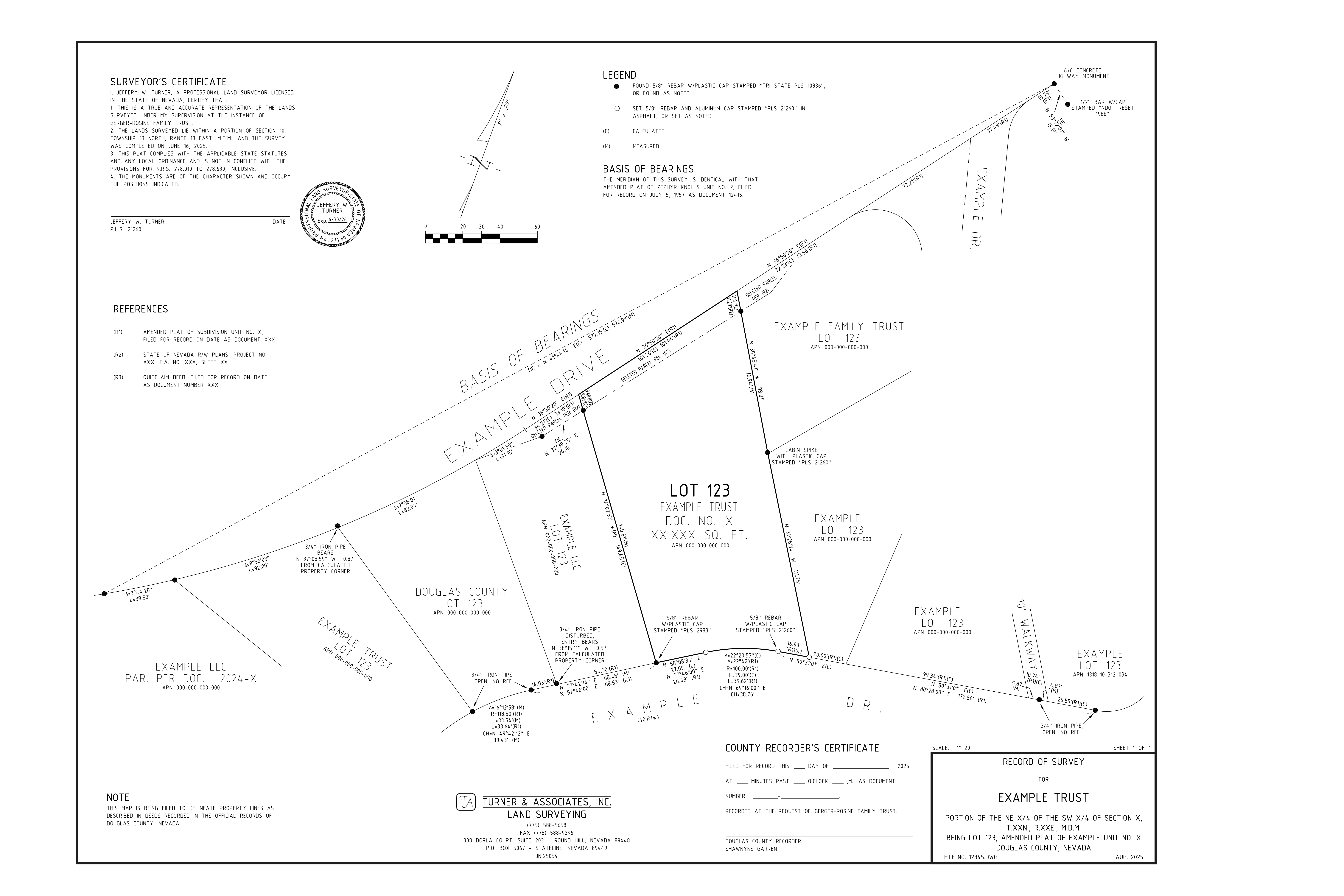
Survey Plat
A final survey plat is prepared showing the boundary, all monuments set and found, bearings and distances, and any encroachments or notes of record. Stamped and signed by a licensed land surveyor.
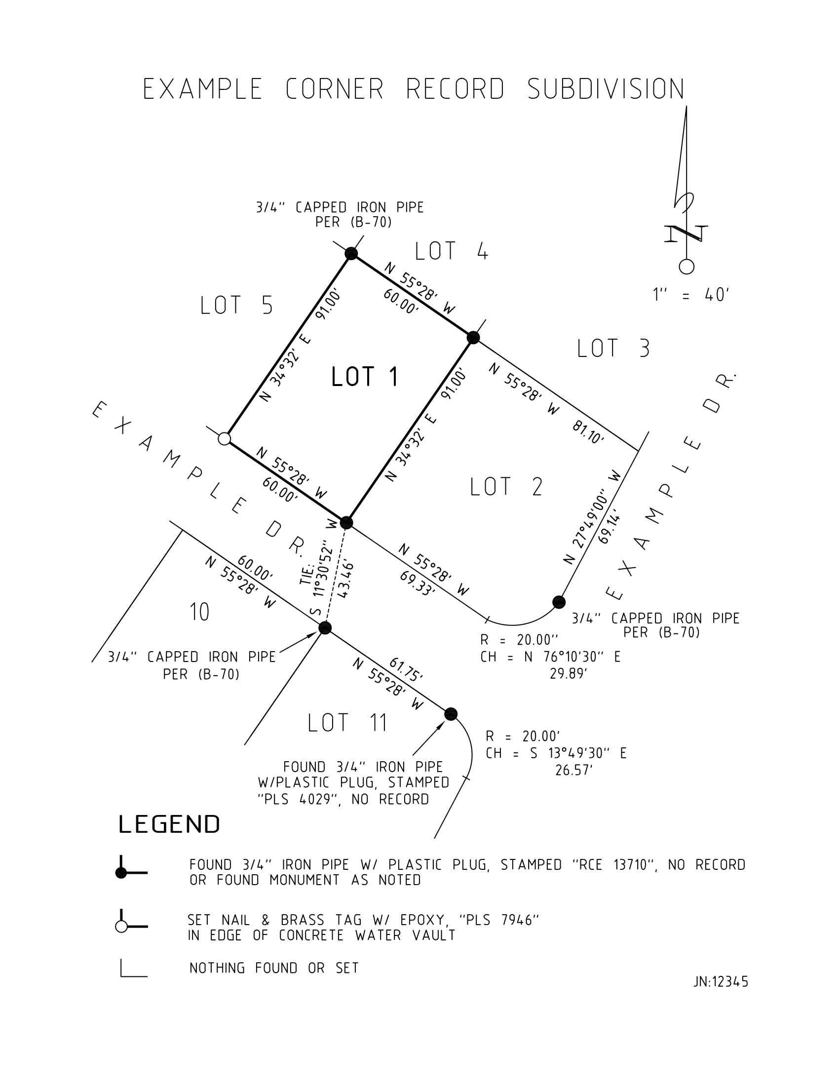
Example Deliverable
What You Receive
Corner Record
Corner Record Example (California Only)