Overview
What is a Topographic Survey?
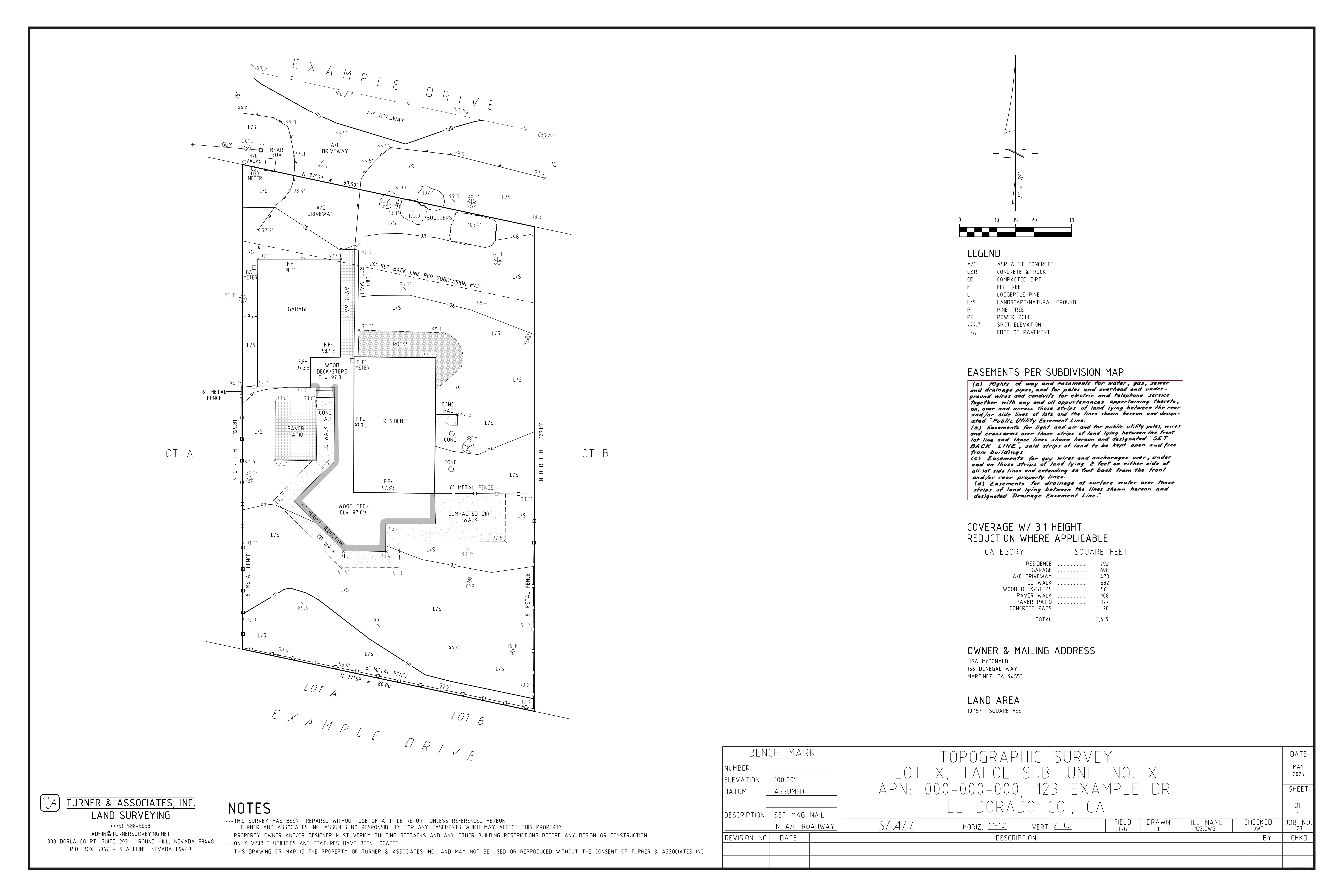
A topographic survey maps everything that physically exists on your property. That includes spot elevations and contours of the land, all structures, impervious surfaces, trees, utilities, fences, and drainage features. The result is a scaled drawing your architect, engineer, or contractor can work from.
In the Lake Tahoe Basin, a topo is also a core part of the permitting process. TRPA uses it to calculate how much of your property is covered by impervious surfaces, which determines what you are and are not allowed to build. That calculation has to be done before any application moves forward.
Getting the topo done early saves time. Projects stall when applicants show up without one, and in this region the permitting process is already slow enough without handing reviewers a reason to send your application back.
Varies by property size and complexity. Contact us for an estimate.
California and Nevada
TRPA and Permitting
Why You Need One
TRPA controls what gets built in the Tahoe Basin
The Tahoe Regional Planning Agency is a bi-state California and Nevada authority with jurisdiction over all development in the Lake Tahoe Basin. It limits how much of each parcel can be covered by impervious surfaces, including buildings, driveways, decks, patios, and compacted soil.
Before approving any project that adds or changes coverage, TRPA needs to verify what already exists on your property. A topographic survey is how that gets documented. Without it, your application is incomplete and will not be reviewed. Most property owners find the process frustrating, and having the right paperwork ready from the start is the best way to keep things moving.
You need a topo if you want to:
Build a new home or structure
Add a deck, patio, or driveway
Add a room or expand your building footprint
Apply for any TRPA or local building permit
Verify your land coverage for TRPA compliance
Give your architect or designer a base map to work from
Scope of Work
What Gets Mapped
Example Deliverable
What You Receive